


The southern half of the U.S. has been rapidly depleting its groundwater over the last decade, according to new scientific research
In New Mexico, the Rio Grande is trickling through Albuquerque at only a quarter of its normal flow. The parched range and pastureland in the southwest part of the state are all rated in poor condition by the Department of Agriculture.
According to the U.S. Drought Monitor published Thursday, 45 percent of the state is suffering from “exceptional” drought — the worst in the nation. Similar conditions exist across much of the southern Great Plains.
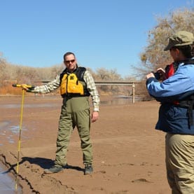
In times like these, when rivers and irrigation canals run dry and the rain fails to fall, farmers and ranchers turn to groundwater, stored beneath the surface of the land, to wet their crops and pastures.
And as persistent drought has become almost a way of life for much of the agricultural land in the U.S., the straw of agriculture is sipping up more and more of the underground water stash.
While some regions have left drought’s clutches for the time being, overall it has been a while since Mother Nature has come around with the rain or snowfall needed for a full refill.
This has left a swath of regions across the southern half of the United States, stretching from West Virginia to California, with significant groundwater depletion since 2003, according to a paper published last week in the journal Science.
A worldwide problem
Scientists and observers of groundwater can see this nationwide change in part because of a satellite program called the NASA Gravity Recovery and Climate Experiment (GRACE), a fascinating effort that is able to measure the changes in water underneath the surface of the land.
In the paper, authors Jay Famiglietti, director of the UC Center for Hydrologic Modeling at the University of California, Irvine, and Matthew Rodell, chief of the Hydrological Sciences Laboratory at the NASA Goddard Space Flight Center, look back at some of the GRACE program’s achievements and call for continued investment in the program to improve management of groundwater resources in the United States and worldwide.
“[There is a] very dire situation that we face right now in the United States that, frankly, I don’t think many people recognize,” Famiglietti said. “I’m talking about the very rapid rates of groundwater depletion.”
In Famiglietti’s paper, there is a colored map of the United States, all blues, greens, yellows and reds. Across the southern section, concentrated red pixels note where total water loss is greater than gain, from 2003 to 2013.

There are a lot of them.
Although on a local level, some water managers may know their groundwater or aquifer is being depleted, Famiglietti highlighted the unique ability of the GRACE satellite to see what is happening with groundwater nationally and even worldwide.
The researcher is working on a global map of groundwater depletion and said that what he sees in America fits with worldwide trends, where arid and semiarid regions are losing groundwater, while more northern latitudes and the tropics are getting wetter.
The Latest Bing News on:
Aquifer depletion
- A wet year boosted California’s groundwater, but not enough to address long-term declineson May 7, 2024 at 9:22 pm
California's groundwater levels rose significantly in 2023, one of the wettest years in decades. State officials say efforts to replenish aquifers helped.
- Groundwater resources in West Billings studied as future development pushes inon April 26, 2024 at 8:30 am
Across the state and beyond, water scarcity, a tale as old as the West, is colliding with the relatively more recent phenomenon of increased demand for housing and development.
- Copper World's proposed aquifer protection permit too weak, Pima County sayson April 13, 2024 at 7:15 am
Arizona needs to strengthen aquifer-protection requirements for the massive proposed Copper World mine to guard against groundwater pollution beneath it, Pima County officials say. The county ...
- Declining aquifer levels raise alarm among hydrologists, officialson April 13, 2024 at 2:30 am
Amid patches of snow and ponderosa pines, a half mile from Lava Island Falls in the Deschutes River, a pair of hydrologists with the Oregon Water Resources Department dropped a cable down an ...
- Kalaeloa wave-pool opponents concerned about effect on aquiferon April 11, 2024 at 5:00 pm
Select an option below to continue reading this premium story. Already a Honolulu Star-Advertiser subscriber? Log in now to continue reading. Honolulu, HI 96813 ...
- Draining the World of Fresh Wateron April 10, 2024 at 5:00 pm
The researchers found that groundwater is dropping in 71 per cent of the studied aquifers. (Much of the world has little data on groundwater depletion.) The rate of decline is accelerating the ...
- Is There A Dark Side To Solar-Powered Irrigation Pumps?on April 5, 2024 at 2:18 pm
Thousands of farmers in Africa and Asia have been using solar power to pump irrigation water — but researchers warn they could also cause an increase in aquifer depletion and carbon emissions.
- Groundwater levels are plummeting around the worldon March 25, 2024 at 12:03 am
Groundwater levels are plummeting at rates of several feet per year in many of the world’s aquifers. The most likely driver of rapid groundwater depletion is unsustainable groundwater pumping.
- 18 Navajo Chapters Oppose Huge Pumped Storage Projects Threatening Arizona’s Black Mesaon July 13, 2023 at 5:00 pm
Even under the best-case scenario, up to 8,000 acre-feet would be lost to evaporation each year, which is nearly double the rate of aquifer depletion from historical coal extraction. The applications ...
- U.S. Urged to Deny Huge Arizona Pump Storage Projects Targeting Black Mesaon January 2, 2023 at 4:00 pm
Even under the rosiest scenario, estimated annual evaporative loss would be up to 8,000 acre-feet annually, which is nearly double the rate of aquifer depletion from historical coal extraction. “These ...
The Latest Google Headlines on:
Aquifer depletion
[google_news title=”” keyword=”aquifer depletion” num_posts=”10″ blurb_length=”0″ show_thumb=”left”]
The Latest Bing News on:
Groundwater depletion
- A wet year boosted California’s groundwater, but not enough to address long-term declineson May 7, 2024 at 9:22 pm
California's groundwater levels rose significantly in 2023, one of the wettest years in decades. State officials say efforts to replenish aquifers helped.
- Sow, transplant saplings as per rice variety, Punjab Agricultural University tells farmerson May 7, 2024 at 9:08 pm
Checking the use of non-recommended rice varieties and combating the challenge of groundwater depletion, the Punjab Agricultural University (PAU) ...
- Groundwater depletion on rise in Keralaon May 7, 2024 at 6:41 pm
Kasaragod: The scorching summer has resulted in water scarcity across the state. Traditional water sources have started drying up. Kerala is headed towards a drought situation. As per the CGWB ...
- BBMP to harvest rainwater along 85-km high-density corridorson May 7, 2024 at 3:54 pm
BBMP integrates advanced rainwater harvesting installations along 85km of high-density corridors in Bengaluru to address water crisis and groundwater depletion. Project aims to streamline water flow ...
- Your Voice Matters: Share Groundwater Concerns in Online Surveyon May 6, 2024 at 7:42 am
Groundwater is needed in the Columbia Basin for a multitude of reasons. It’s a crucial freshwater source for domestic, agricultural, industrial, and commercial purposes. It’s connected to surface ...
- Seismic waves used to track LA's groundwater recharge after record wet winteron May 4, 2024 at 1:25 am
Record-setting storms in 2023 filled California's major reservoirs to the brim, providing some relief in a decades-long drought, but how much of that record rain trickled underground?
- Feds agree to deadline for endangered species listing of rare NV fishon April 29, 2024 at 2:45 pm
Federal wildlife managers Thursday agreed to decide whether or not to list a rare Nevada fish as a threatened or endangered species within the next year after failing to meet a federally required ...
- Dip in groundwater table raises concern in Mys diston April 28, 2024 at 4:39 pm
Mysuru: Amid soaring temperature, the sharp decline in groundwater table during this summer has raised concern in Mysuru city and district.
- Prayagraj to fight groundwater depletion with rainwater harvesting in public parkson April 27, 2024 at 6:14 pm
To combat the rapid groundwater depletion in the city, the Prayagraj Municipal Corporation (PMC) has initiated a project to install rainwater harvesting systems in 100 public parks across the ...
- Groundwater resources in West Billings studied as future development pushes inon April 26, 2024 at 8:30 am
Across the state and beyond, water scarcity, a tale as old as the West, is colliding with the relatively more recent phenomenon of increased demand for housing and development.
The Latest Google Headlines on:
Groundwater depletion
[google_news title=”” keyword=”groundwater depletion” num_posts=”10″ blurb_length=”0″ show_thumb=”left”]

