


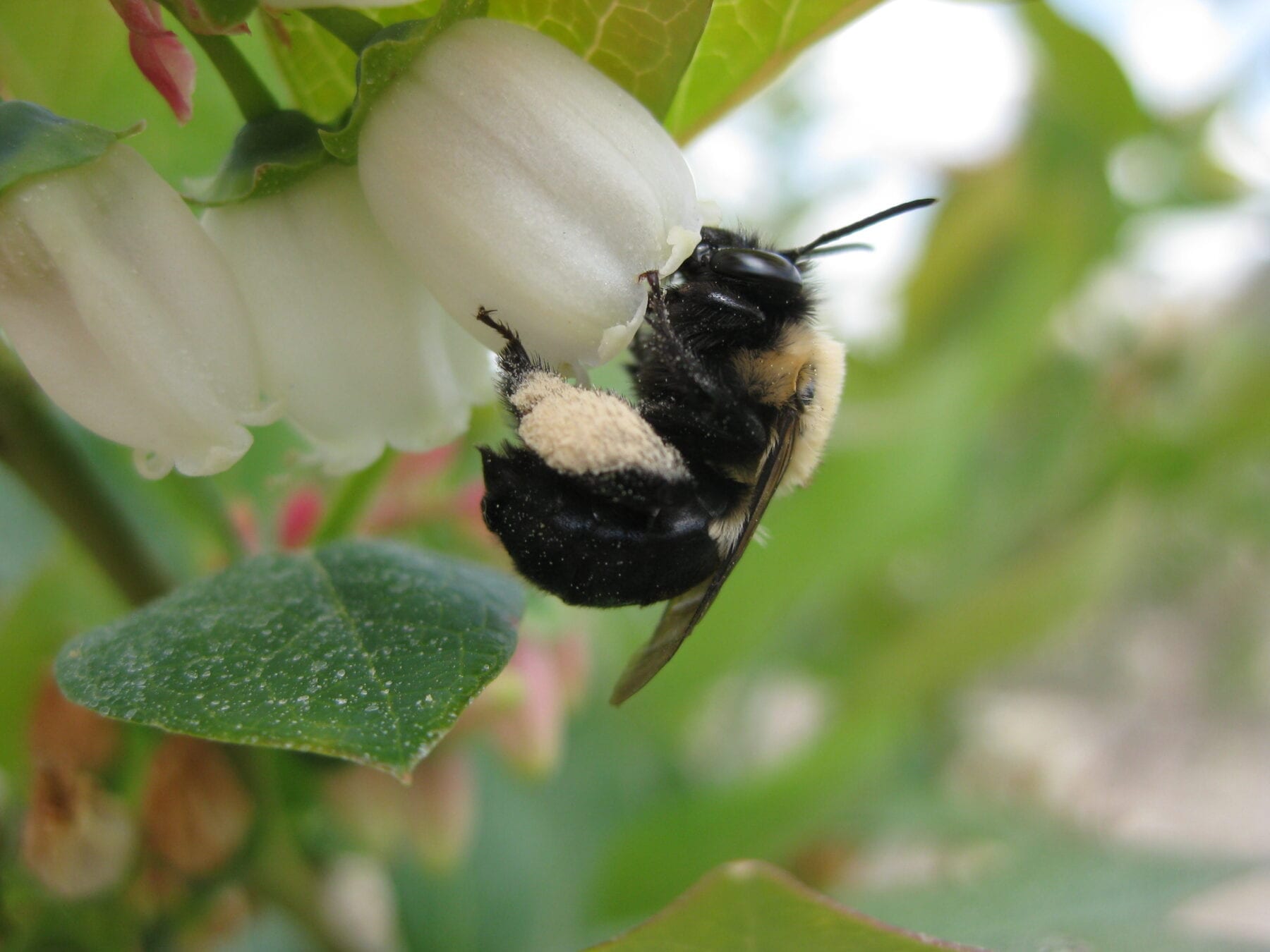
Drone image showing the distribution of wildflowers.
Credit: Karen Anderson
Satellites and drones can provide key information to protect pollinators, researchers say.
Their study examines new ways of using these technologies to track the availability of flowers, and says this could be combined with behavioural studies to see the world through the eyes of insects.
The flowers available to insects vary from day to day and place to place, and human activity is changing landscapes in ways that affect all pollinators.
The University of Exeter research team, supported by the South Devon Area of Outstanding Natural Beauty (AONB), hope their approach can help us understand these changes, leading to better conservation.
“Recent advances in drone and satellite technology have created new opportunities,” said lead author Dunia Gonzales, from the Centre for Research in Animal Behaviour at the University of Exeter.
“Drones can now give us fine details of a landscape – on the scale of individual flowers – and combining this with satellite imagery, we can learn about the food available to pollinators across a large area.
“Along with behavioural studies of insects, this will help us understand the threats they face and how to design conservation programmes.
“With some pollinator species in decline, including many wild bees, we urgently need this understanding to protect not just pollinators in general but also the great diversity of species that each play vital roles in complex ecosystems.”
Pollinators provide a range of benefits (called ecosystem services), especially to humans by pollinating food crops.
However, much about their behaviour and habitats – and the impact of climate and habitat change caused by humans – remains unknown.
“Up to now, most research using satellites has focused on large-scale agricultural landscapes such as oilseed rape, maize and almond farms,” Gonzales said.
“We highlight the need to study landscapes with complex communities of plants and pollinators.
“These vary from place to place – and using satellites and drones together is a good way to learn about these local differences.
“For example, the South Devon AONB contains many smaller fields, microhabitats and traditional Devon hedgerows – so effective conservation here might be different from the measures that would work elsewhere.”
Original Article: Satellites and drones can help save pollinators
More from: University of Exeter
The Latest Updates from Bing News & Google News
Go deeper with Bing News on:
Saving pollinators
- Atreya Manaswi is saving bees with beer. What’s next?
The older man was describing the dramatic drop in production from his family’s hives — from the same kinds of problems that are causing a rapid decline in the pollinator population worldwide. It ...
- Atreya Manaswi is saving bees with beer. What’s next? | Central Floridian of the Year Finalist
The older man was describing the dramatic drop in production from his family’s hives — from the same kinds of problems that are causing a rapid decline in the pollinator population ... potentially can ...
- Promote Pollinator Progress @ Puyallup's Peck Property - Join the May 4th Work Party!
PM on Saturday, May 4th, at the Peck Property in Puyallup! Volunteers will help care for existing plants and continue efforts to remove ...
- Exploring eco-friendly lawns: Saving time, money, and benefiting pollinators
With the recent rain falls and the upcoming rain later this week lawns are finally starting to look green again --But the ongoing drought over the last few year ...
- New Jersey high school student helps develop way to save bee population from destructive pests
Katie Culbert from Toms River thinks she found a way to protect bees from varroa mite, one of the most destructive pests.
Go deeper with Google Headlines on:
Saving pollinators
[google_news title=”” keyword=”saving pollinators” num_posts=”5″ blurb_length=”0″ show_thumb=”left”]
Go deeper with Bing News on:
Tracking pollinators using drones and satellites
- Wildlife from space: Winners of Satellites for Biodiversity Award named
The Airbus Foundation and the Connected Conservation Foundation have announced the winners of the second edition of their Satellites for Biodiversity Award. The four winners of the award are ...
- Earth Day 2024: Pollinators help our food supply
If there’s food on your table, you can thank a bee. Or a fly. Or even a moth. They’re types of pollinators, and they help to produce about 75% of the world’s major food crops, according to Dr.
- Drones, maps, and storm-tracking in the Pacific
The agency, which is typically known for its contribution to weather forecasting and works closely with the National Geospatial-Intelligence Agency, has been using drones to bolster its mapping ...
- Bees vs drones: How tech is tackling crop pollination
Agriculture is among the top users of drones worldwide. Their growing use in pollination – both in covered farming and in fields – is driven by declines in bee populations because of warmer ...
- FEATURE-Bees vs. drones: How tech is tackling crop pollination
Agriculture is among the top users of drones worldwide. Their growing use in pollination – both in covered farming and in fields – is driven by declines in bee populations because of warmer ...
Go deeper with Google Headlines on:
Tracking pollinators using drones and satellites
[google_news title=”” keyword=”tracking pollinators using drones and satellites” num_posts=”5″ blurb_length=”0″ show_thumb=”left”]
