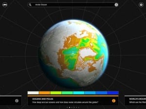
Instead of merely showing borders, this new atlas lets you play around with data big and small about the planet today–and its future.
Atlases used to be dusty old things your family stored on a living-room bookshelf. Not any more. Now they look like this.
With data on 200,000 locations around the world, this new app from Collins takes things up a few notches from that giant, instantly out-of-date tome that once took up space on your bookshelf, allowing you to swipe through continents, oceans, rivers, forests, and deserts in deep 3-D detail. You can dive in to get information on capitals, towns and villages, and switch between physical, political, and satellite globes, depending on your preference. Meanwhile, there are globes covering the environment, energy, population, and communications, with others on World Heritage Sites and climate change coming to the app soon.
As well as bringing the material world to life in colorful, interactive detail, the app also includes a trove of facts on our interaction with it. For example, you can view countries by rates of immigration, child birth, and cell phone use. You can look up areas of Africa according to their development: whether they have been urbanized, or left pristine. And you can see how much forest we’ve cut down, how much CO2 we’ve put in the atmosphere, and other ecological horrors.
via FastCoExist – Ben Schiller
The Latest Streaming News: Atlas App updated minute-by-minute
Bookmark this page and come back often
Latest NEWS
Latest VIDEO


