


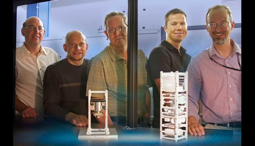
A team of Lawrence Livermore National Laboratory scientists are using mini-satellites that work as “space cops” to help control traffic in space.
The scientists used a series of six images over a 60-hour period taken from a ground-based satellite to prove that it is possible to refine the orbit of another satellite in low earth orbit.
“Eventually our satellite will be orbiting and making the same sort of observations to help prevent satellite-on-satellite and satellite-on-debris collisions in space,” said Lance Simms, lead author of a paper appearing in an upcoming edition of the Journal of Small Satellites.
Collisions in space of satellites and space debris have become increasingly problematic.
To help satellite operators prevent collisions in space, the Space-Based Telescopes for Actionable Refinement of Ephemeris (STARE) mission, which will consist of a constellation of nano-satellites in low earth orbit, intends to refine orbits of satellites and space debris to less than 100 meters. STARE is an ongoing LLNL project led by Wim de Vries, with Vincent Riot as lead engineer.
Using the ground-based satellite, the Livermore team refined the orbit of the satellite NORAD 27006, based on the first four observations made within the initial 24 hours, and predicted NORAD’s trajectory to within less than 50 meters over the following 36 hours.
By refining the trajectory of NORAD 27006 with their ground-based payload, the team believes they will be able to do the same thing for other satellites and debris once their payload is orbiting earth.
The tools and analysis used to capture the images of NORAD 27006 and refine its orbit are the same ones that will be used during the STARE mission.
“This leads credence to the capability of STARE to accomplish its mission objectives,” De Vries said.
Accurately predicting the location of a satellite in low earth orbit at any given time is difficult mainly because of the uncertainty in the quantities needed for the equations of motion. Atmospheric drag, for instance, is a function of the shape and mass of the satellite as well as the density and composition of the unstable atmosphere. These uncertainties and the incompleteness of the equations of motion lead to a quickly growing error in the position and velocity of any satellite being tracked in low earth orbit.
To account for these errors, the Space Surveillance Network (SSN) must repeatedly observe the set of nearly 20,000 objects it tracks; however, positional uncertainty of an object is about 1 kilometer. This lack of precision leads to approximately 10,000 false alarms per expected collision. With these large uncertainties and high false alarm rates, satellite operators are rarely motivated to move their assets after a collision warning is issued.
The STARE mission aims to reduce the 1 kilometer uncertainty down to 100 meters or smaller, which will in turn reduce the number of false alarms by roughly two orders of magnitude, Riot said.
The Latest on: Traffic in space
[google_news title=”” keyword=”Traffic in space” num_posts=”10″ blurb_length=”0″ show_thumb=”left”]
via Google News
The Latest on: Traffic in space
- Learn how to zipper merge, or else I-75 construction traffic is going to be painful for weekson May 13, 2024 at 2:40 pm
Everyone needs to leave space between them and the vehicle in front of them so people can merge without stopping or slowing.
- Waynesboro traffic garden, greenway to provide a safe space to learn to ride a bikeon May 13, 2024 at 2:31 pm
A joint project of the City of Waynesboro Parks and Recreation Department, the Central Shenandoah Valley Office on Youth and the Rotary Club of Waynesboro, construction is slated to begin later this ...
- Wayfair's Rug Sale Ends Tonight — Save Up to 60% on Indoor and Outdoor Rugs for Every Spaceon May 13, 2024 at 11:07 am
Until tonight, May 13, you can save up to 60% on rugs for every room in your home. Whether you’re looking for an outdoor rug to prep your backyard ahead of Memorial Day or a washable option that makes ...
- NYC Traffic and Parking: Is Congestion Pricing The Answer?on May 13, 2024 at 10:46 am
But lately, New York City streets are teetering between lively and unlivable. Residents clash over traffic, noise, parking, 5G towers and heaps of trash. Most years, far fewer pedestrians get killed ...
- Cemex tells Boulder County to ignore the traffic study it paid for that led to plant’s shutdownon May 13, 2024 at 3:07 am
Cemex rejected Boulder County's calls for its closure, saying a traffic study the cement company paid for is unreliable.
- Former church site in Pooler gets OK for redevelopment into retail space, community centeron May 13, 2024 at 2:21 am
The land where the now-closed Christ Presbyterian Church currently sits on Quacco Road may soon be 23,000 sq. ft. of retail/commercial space and a 10,000 sq. ft. community event center, along with ...
- ‘Cyclists are just lumped in with general traffic’: Change is coming for Dublin’s dangerous junctionson May 11, 2024 at 9:59 pm
One in four cycling fatalities occur at junctions. Can changes to traffic design make cycling in the city safer?
- Forbes released its list of worst U.S. cities to drive in. Here's where Houston rankson May 10, 2024 at 6:00 am
Driving in Texas continues to get a bad rap. Houston ranked as one of the worst cities to drive in, according to a new report by Forbes Advisor.
- Pea Ridge mayor says retail space increasing in city, talks about traffic congestionon May 8, 2024 at 11:02 pm
The mayor talked about an online "project tracker" which residents can use to find information about both residential and commercial development in the city. The tracker can be found at cityofpearidge ...
- Wozniak's Space Firm, Privateer, Buys Orbital Insight, Raises $56.5 Millionon May 7, 2024 at 6:04 am
Apple cofounder Steve Wozniak's space data startup, Privateer, has raised $56.5 million and also acquired the analytics firm Orbital Insight, a merger that will add mapping and intelligence services ...
via Bing News

