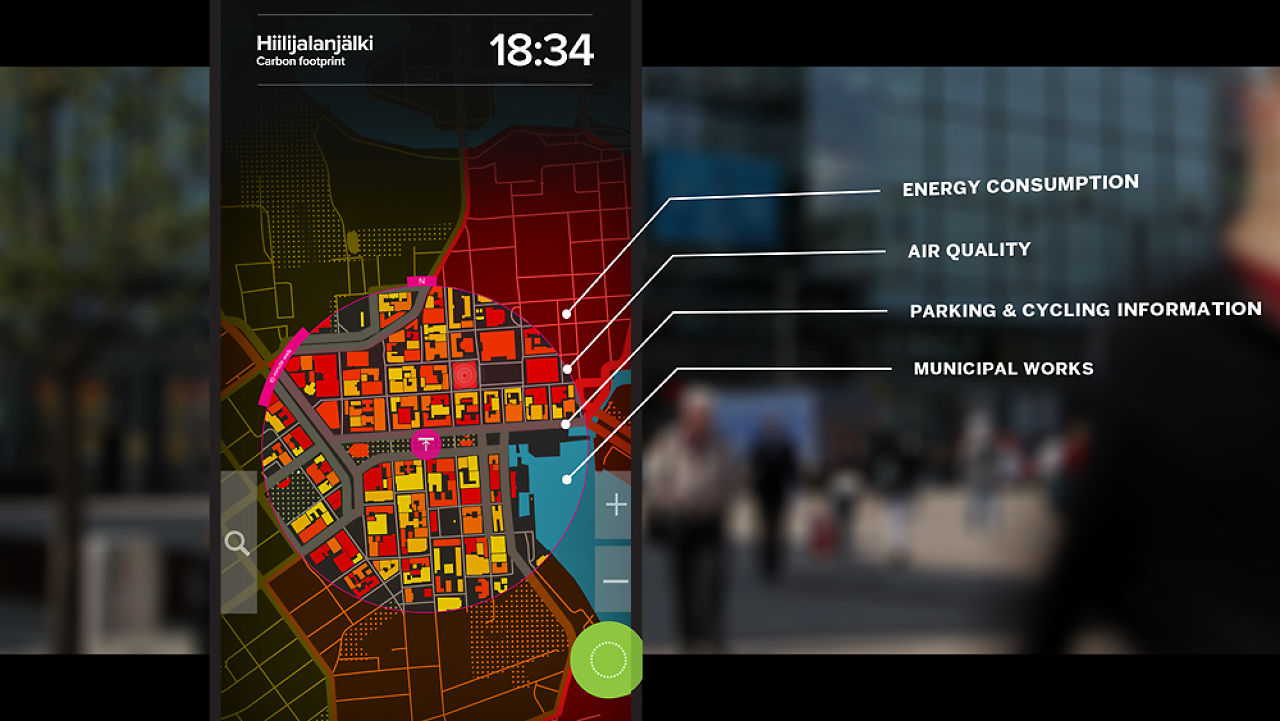
Urbanflow, an information system that both tourists and local people might actually want to use.
Combining a map, tourist information, and data about the city’s services, a new system is making Helsinki truly transparent.
According to Adam Greenfield, most public information systems aren’t very useful. He reckons a lot of kiosks you see in stations, plazas, and on sidewalks are expensive white elephants: a nice idea in some official’s mind, but not something that real people want to actually delve into on a consistent basis.
“Our research suggests that the overwhelming majority of these remain woefully underutilized, resulting in virtually no return on the significant investment involved in installing and maintaining them,” he says, referring to his New York urban systems design practice, Urbanscale.
Greenfield’s firm has teamed up with another in Helsinki, called Nordkapp, to develop something better. The result is what they call Urbanflow, an information system that both tourists and local people might actually want to use.
Urbanflow provides layers of data: a way-finder allowing people to map A to B and find out about local services, and a mass of “ambient” city data on air quality, traffic density, parking, cycling, and public transport. Urbanflow is two-way: Users glean information, but also feed it back, for example reporting on, say, faulty streetlights or vandalism.
Read more . . .
Bookmark this page for “public information systems” and check back regularly as these articles update on a very frequent basis. The view is set to “news”. Try clicking on “video” and “2” for more articles.


