


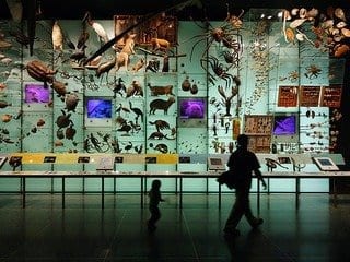
Plant species diversity in four different ecosystems represented as spectral variation.
(Image: Anna Schweiger, Etienne Laliberté)
Global biodiversity assessments require the collection of data on changes in plant biodiversity on an ongoing basis. Researchers from the universities of Zurich and Montréal have now shown that plant communities can be reliably monitored using imaging spectroscopy, which in the future will be possible via satellite. This paves the way for near real-time global biodiversity monitoring.
Internationally comparable data on biodiversity is needed to protect threatened ecosystems, restore destroyed habitats and counteract the negative effects of global biodiversity loss. Current biodiversity monitoring, however, is labor-intensive and costly. In addition, many places around the world are difficult to access.
Biodiversity monitoring from space possible via satellite
Anna Schweiger from the Remote Sensing Laboratories at the Department of Geography, University of Zurich (UZH), and Etienne Laliberté from the University of Montréal, have now shown that plant biodiversity across ecosystems ranging from Arctic tundra to tropical forests can be reliably assessed using image spectrometry. “With our study, we hope to contribute to the future detection of changes in species composition of our Earth’s ecosystems from space. The goal is to provide evidence-based guidance for policy measures to protect species and mitigate negative consequences of biodiversity loss,” says first author Anna Schweiger.
Imaging spectrometers measure the reflectance of light from the visible to the shortwave infrared range of the electromagnetic spectrum. The reflectance of plants is determined by their chemical, anatomical and morphological characteristics, which are important for interactions among plants and with their environment. “Plants with similar traits, as well as closely related species, therefore tend to have similar reflectance spectra,” explains Schweiger.
Using reflected light to assess the characteristics of individual plants and plant communities
The current study is a continuation of the researchers’ work on spectral diversity metrics. Their indices calculate spectral variation among individual plants within communities, and among communities within a region. The diversity within communities is called alpha-diversity, while the diversity among communities is called beta-diversity.
Data for the study came from the National Ecological Observatory Network (NEON). The network uses standardized methods to collect biodiversity and Earth observation data across the United States which are then made publicly available. NEON imaging spectrometer data collected from research flights have a pixel size of 1×1 meter.
Spectral diversity calculations showed that the detection of alpha-diversity depends on plant size. Spectral diversity calculated in forests with closed canopies and large individual trees matched plant diversity determined on the ground better than spectral diversity calculated in open landscapes dominated by small herbaceous plants and grasses. Spectral beta-diversity, however, captured differences in plant community composition across all ecosystems studied based on a spatial resolution of 20×20 meters. This pixel size corresponds to the size of NEON’s vegetation inventory plots.
Monitor global biodiversity in near real time
Both the European Space Agency (ESA) and its North American counterpart NASA are currently developing satellite-based image spectrometers. These are intended to image the entire globe approximately every 16 days with a pixel size of about 30×30 meters. The study’s results illustrate that these data should allow detecting ecosystem changes as they happen. “Our study will help to effectively and reliably determine changes in plant community composition via satellite in the foreseeable future. This will facilitate targeted field campaigns to assess the causes and consequences of ecosystem change allowing stakeholders to react in due time,” says Anna Schweiger. According to Schweiger, global monitoring of biodiversity – almost in real time – is now within reach.
Original Article: Satellite Monitoring of Biodiversity Moves Within Reach
More from: University of Zurich | Université de Montréal
The Latest Updates from Bing News & Google News
Go deeper with Bing News on:
Global biodiversity monitoring
- Invasive lionfish continue conquering global marine ecosystems
The Mediterranean Sea, the largest enclosed sea on Earth, is a unique ecosystem that is now threatened by invasive lionfish.
- First-of-its-kind study shows conservation interventions are critical to halting and reversing biodiversity loss
A new study in the scientific journal Science provides the strongest evidence to date that not only is environmental conservation successful, but that scaling conservation interventions up would be ...
- Global Conservation leaders unite in Saudi Arabia's Hima protected areas forum
The inaugural Hima Protected Areas Forum concluded in Riyadh on April 24th, marking a historic moment in the realm of conservation and sustainable development. Organized by the National Center for ...
- Wildlife from space: Winners of Satellites for Biodiversity Award named
The Airbus Foundation and the Connected Conservation Foundation have announced the winners of the second edition of their Satellites for Biodiversity Award. The four winners of the award are ...
- Global Conservation Leaders Unite in Saudi Arabia's Hima Protected Areas Forum, Setting Bold Agenda for Sustainable Future
The inaugural Hima Protected Areas Forum concluded in Riyadh on April 24th, marking a historic moment in the realm of conservation and sustainable development. Organized by the National Center for ...
Go deeper with Google Headlines on:
Global biodiversity monitoring
[google_news title=”” keyword=”global biodiversity monitoring” num_posts=”5″ blurb_length=”0″ show_thumb=”left”]
Go deeper with Bing News on:
Satellite-based image spectrometers
- ‘Invisible’ contributor: Methane leaks from landfills are likely worse than previously thought
A new study looking at landfill emissions revealed the industrial waste dumps are likely punching above their weight when it comes to methane leaks. The report, which revealed a significant ...
- Researchers develop performance technology for aerial and satellite image extraction
The development of the world's most performant neural network module for accurately extracting objects from aerial and satellite imagery is expected to have wide applications across various fields, ...
- How Old Is the Solar System, and How Did It Form?
Earth, between sweltering Venus and frozen Mars, formed and orbits within a band where water could persist in solid, liquid, and gaseous phases. Mars had surface water, but not as much as Earth, and ...
- Far more climate-warming methane leaks into the atmosphere than is reported. Satellites can help
Methane’s ability to warm the planet is nearly 30 times greater than carbon dioxide’s over 100 years, and more than 80 times over 20 years. You can think of methane as being a very effective blanket ...
- Satellites can help find and stop methane leaks
Riley Duren, a research scientist at the University of Arizona, explained how new satellites are changing companies' and governments' ability to find and stop methane leaks and avoid wasting a ...
Go deeper with Google Headlines on:
Satellite-based image spectrometers
[google_news title=”” keyword=”satellite-based image spectrometers” num_posts=”5″ blurb_length=”0″ show_thumb=”left”]
