


Rocky outcrop in the Flinders Ranges north of Hawker, South Australia. 1992.
via UNIVERSITY OF SOUTH AUSTRALIA
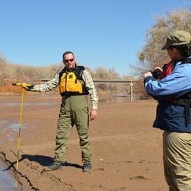
We live in the driest state in the driest continent, with water a scarce commodity and a major environmental, biological and socio-economic issue for many communities across South Australia.
Now, thanks to UniSA researcher Dr Alaa Ahmed, new cost-effective technology can pinpoint sites in the central Flinders Ranges where precious groundwater is likely to be found, handing a lifeline to residents in that region.
Using satellite imagery, geospatial techniques and adding information on drainage, rock types, fractures, topography and rainfall, Dr Ahmed has mapped the Hawker region into three distinct classifications for groundwater stored in fractured rock aquifers: good, moderate and low.
His study indicates that the most effective groundwater recharge zones (where surface water collects as it moves downwards) are located where there are numerous rock fractures, low drainage and a gentle slope.
Conversely, the least effective areas to find groundwater are underlain by shale and siltstone.
“The remote sensing doesn’t cost us anything because existing satellites located above Australia are already taking photos of the topography. We also have the software – GIS – to analyse and map all the data,” Dr Ahmed says.
Existing methods to assess groundwater sources involve extensive drilling, which is expensive, time consuming and often inaccurate.
Using a combination of remote sensing, GIS and information and other geological factors, hydrologists should be able to find precise groundwater locations at a fraction of the cost, he says.
“Groundwater makes up approximately 17 per cent of Australia’s available water resources, 30 per cent of its consumption and is found across 60 per cent of the continent.
“But prolonged droughts have led to higher salinity and pumping costs and fewer groundwater sites.
“We urgently need to find faster and cheaper ways to locate groundwater because water supplies are limited in so many parts of the country. By creating satellite maps showing where groundwater is more likely to be found, we can go a long way towards improving our water resources,” he says.
Groundwater is the main source of fresh water in the Flinders Ranges and is affected by the type, thickness and structural fabric of the underlying rocks, erosion, topography, drainage and the climate.
While the central Flinders Ranges lies north of Goyder’s Line, deemed unsuitable for cropping, sheep and cattle farming still needs a reliable source of water, as do the townships of Hawker and Parachilna.
Both towns are reliant on groundwater from fractured rock aquifers for their water supply and are dependent on limited production wells.
While this study was undertaken in South Australia, the same technique could be used to detect groundwater in any arid region across the world, including Egypt, where Dr Ahmed has carried out similar research.
“Water shortages and high salinity affect many countries. With global warming, we can expect to see more droughts and so water will become an even scarcer resource. Hopefully this technology will help ensure we have sustainable water supplies for decades to come.
“It will enable policymakers to decide potential sites for recharging the groundwater aquifers without depleting or harming the environment,” he says.
Dr Ahmed’s study has been published in the journal Water, with contributions from colleagues in the Desert Research Centre, Egypt, and King Abdulaziz City for Science and Technology, Saudi Arabia.
Original Article: Eureka – a cost effective and quick way to find groundwater
More from: University of South Australia | Desert Research Center | King Abdulaziz City for Science and Technology
The Latest Updates from Bing News & Google News
Go deeper with Bing News on:
Finding groundwater
- Report: Drought continues to have negative effect on Nebraska groundwater levels
A UNL report showed 85% of the 4,822 wells measured statewide showed declines from spring 2022 to spring 2023, with an average decline across all wells of 1.65 feet.
- A look at groundwater in the Bitterroot
Michael Howell “Whiskey is for drinking; water is for fighting.” Insightful claims are often attributed to some indubitable source to bolster their credibility. This quote is most often attributed ...
- Waterloo idles drinking water well contaminated by ‘forever chemicals’
A well among those providing Waterloo's drinking water supply is shut down after sampling turns up cancer-linked PFAS ...
- GHMC initiates plan to boost groundwater levels with RWH
According to GHMC, they are encouraging citizens to construct rainwater harvesting structures in every house, office building, commercial complex, factory, industry, and all other structures to ...
- As California cracks down on groundwater, what will happen to fallowed farmland?
California is cracking down on the overuse of groundwater, which could idle farmland and poses questions about the future of fallowed fields.
Go deeper with Google Headlines on:
Finding groundwater
[google_news title=”” keyword=”finding groundwater” num_posts=”5″ blurb_length=”0″ show_thumb=”left”]
Go deeper with Bing News on:
Groundwater
- A new book examines the groundwater crisis – and its politics – in Gujarat
However, once the realisation came that groundwater was a very cheap and “efficient” alternative to major and medium irrigation works, the exploitation of groundwater began at an accelerated pace. The ...
- Nebraska groundwater levels continue decline after prolonged drought
Groundwater levels in much of Nebraska continue to decline after several years of prolonged drought, according to a report.
- Report: Drought continues to have negative effect on Nebraska groundwater levels
A UNL report showed 85% of the 4,822 wells measured statewide showed declines from spring 2022 to spring 2023, with an average decline across all wells of 1.65 feet.
- Walters: As California cracks down on groundwater, what will happen to fallowed farmland?
Curtailing groundwater use is not an isolated event, but rather a significant piece of the state’s declared intent to reduce the share of water devoted to agriculture — roughly three quarters of ...
- ‘We need to treat this as an emergency’: Eastern Oregonians await action from state, feds on groundwater contamination
It’s been more than 30 years since it was first learned that there were problems with toxic chemicals called nitrates seeping into the drinking water in Morrow and Umatilla counties. And since then, ...
Go deeper with Google Headlines on:
Groundwater
[google_news title=”” keyword=”groundwater” num_posts=”5″ blurb_length=”0″ show_thumb=”left”]

