“We have managed to improve the determination of a vehicle’s position in critical cases by between 50 and 90 percent”
Researchers at Universidad Carlos III de Madrid (UC3M) have developed a new system which improves the ability of a GPS to determine a vehicle’s position as compared to that of conventional GPS devices by up to 90 percent, and which can be installed in any vehicle at a very low cost.
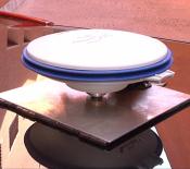
The system, which is based on sensorial fusion, was jointly designed and developed by the Applied Artificial Intelligence Group (GIAA – Grupo de Inteligencia Aplicada Artificial) and the Systems Intelligence Laboratory (LSI – Laboratorio de Sistemas Inteligentes) at UC3M. The prototype incorporates a conventional GPS signal with those of other sensors (accelerometers and gyroscopes) in order to reduce the margin of error in establishing a location. “We have managed to improve the determination of a vehicle’s position in critical cases by between 50 and 90 percent, depending on the degree of the signals’ degradation and the time that is affecting the degradation on the GPS receiver,” states David Martín, a researcher at the LSI.
The margin of error of a commercial GPS, such as those that are used in cars, is about 15 meters in an open field, where the receiver has wide visibility from the satellites. However, in an urban setting, the determination of a vehicle’s position can be off by more than 50 meters, due to the signals bouncing off of obstacles like buildings, trees, or narrow streets, for example. In certain cases, such as in tunnels, communication is lost, which hinders the GPS’s applications reaching Intelligent Transport Systems, which require a high level of security. “Future applications that will benefit from the technology that we are currently working on will include cooperative driving, automatic maneuvers for the safety of pedestrians, autonomous vehicles or cooperative collision warning systems,” the scientists comment.
The greatest problem presented by a commercial GPS in an urban setting is the loss of all of the satellite signals. “This occurs continually, but commercial receivers partially solve the problem by making use of the urban maps that attempt to position the vehicle in an approximate point,” comments David Martín. “These devices,” he continues, “can indicate to the driver approximately where s/he is, but they cannot be used as a source of information in an Intelligent Transport System like those we have cited.” However, in the case of the new prototype that they have developed they have managed to guarantee the position of the vehicle to within 1 or 2 meters in urban settings.
via Carlos III University of Madrid
The Latest Streaming News: GPS updated minute-by-minute
Bookmark this page and come back often
Latest NEWS
Latest VIDEO


